Janet Craven, Kathryn Davies, Jan Deakin, Dudley Hoddinott, Rona Marsden, Tim Pottle & Chris Westcott and ONH
Abstract
This document has been created by residents of Cumnor Hill, with additional input from Dr Kathryn Davies and supports the over-arching Character Assessment for Cumnor Parish. Cumnor Hill is one of the four wards that make up Cumnor Parish. To create the content of this document contributors used a combination of desk top research, field observations and interviews with local residents. In order to assess the area fully, the area has been split into 11 areas.
This assessment was conducted between February and September 2017 as part of the set of documents that make up the evidence base of the Cumnor Parish Neighbourhood Plan. For further information, please visit www.cumnorplan.co.uk or contact clerk@cumnorparishcouncil.org.uk
A modifications project was undertaken in 2025 which allowed the opportunity to add additional analysis and clarify local design expectations for future schemes.
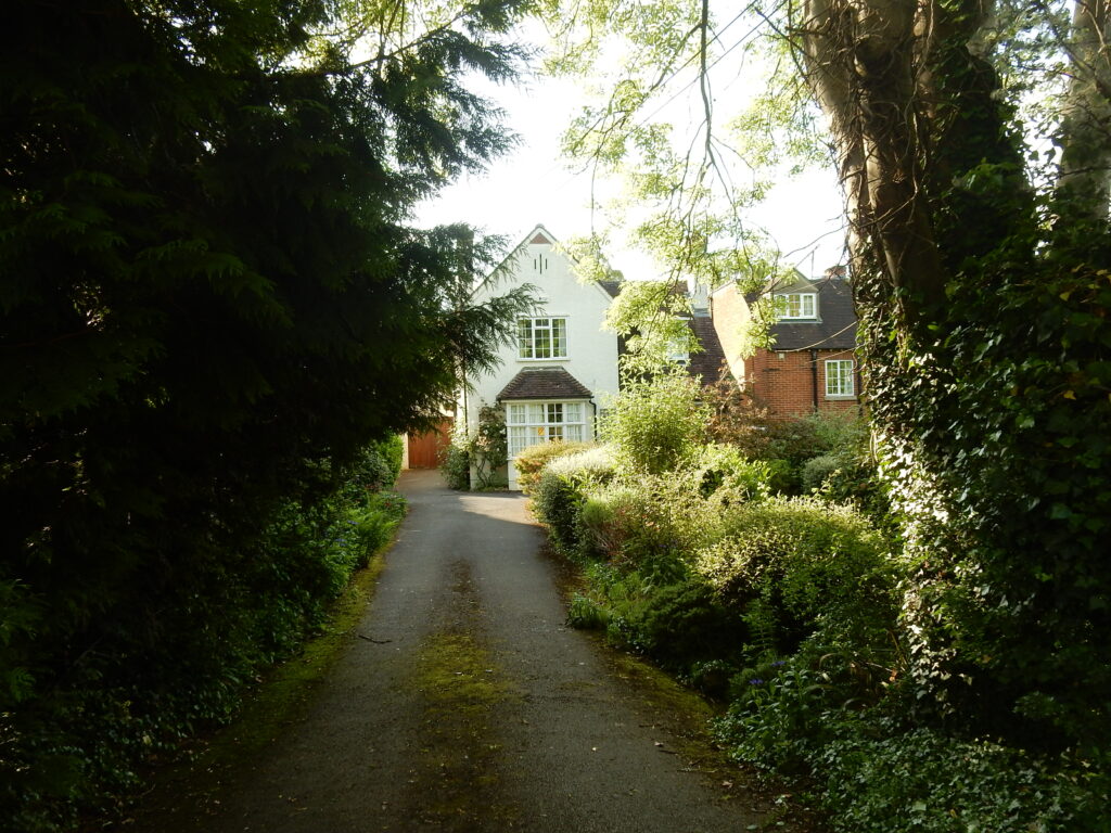
i. Chawley Lane
Chawley Lane
Spaces: gaps between built elements – streets, gardens etc.
Hints: Formal, building plots (size, building position, etc), means of enclosure, gaps, open, narrow, winding, straight, type of use, paving/surface materials, street furniture, usability, impact of traffic.
SCORE: 4
Norreys Road and Bertie Road were developed as a consequence of the financial demise of the 4th Earl of Abingdon, who sold off this tract of land to pay debts. The land was not developed until the 1930s. The buildings at Chawley Lane however, were built to house workers at the Chawley Brickworks and as a result are very different in character. Both types of housing tell the story of the history of the area in quite different ways.
Chawley Lane is a narrow, dead end, roughly surfaced, single track road that leads down to open fields. The further down the lane the more the countryside opens up to provide spectacular views across open countryside.
Plots on Chawley Lane range from small to large with gardens of corresponding sizes. Generally rectangular with slight variation to this shape where plots are accommodating curvature and gradients. Irregular plot shapes also feature depending on topography and development history but are not common. Creating additional irregular plot shapes may be resisted as this could undermine the strong character formed by common plot shapes.
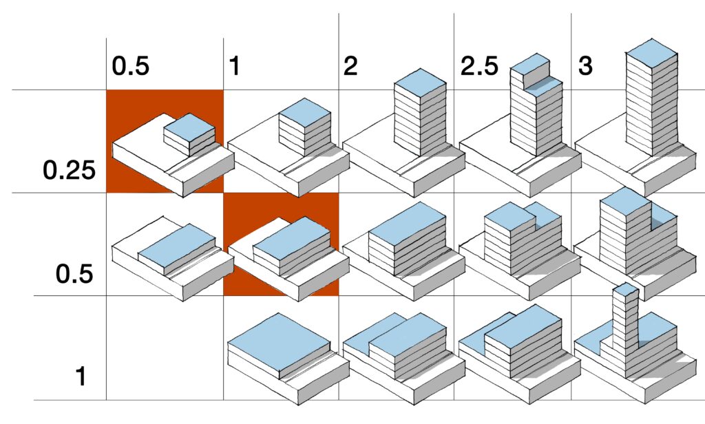
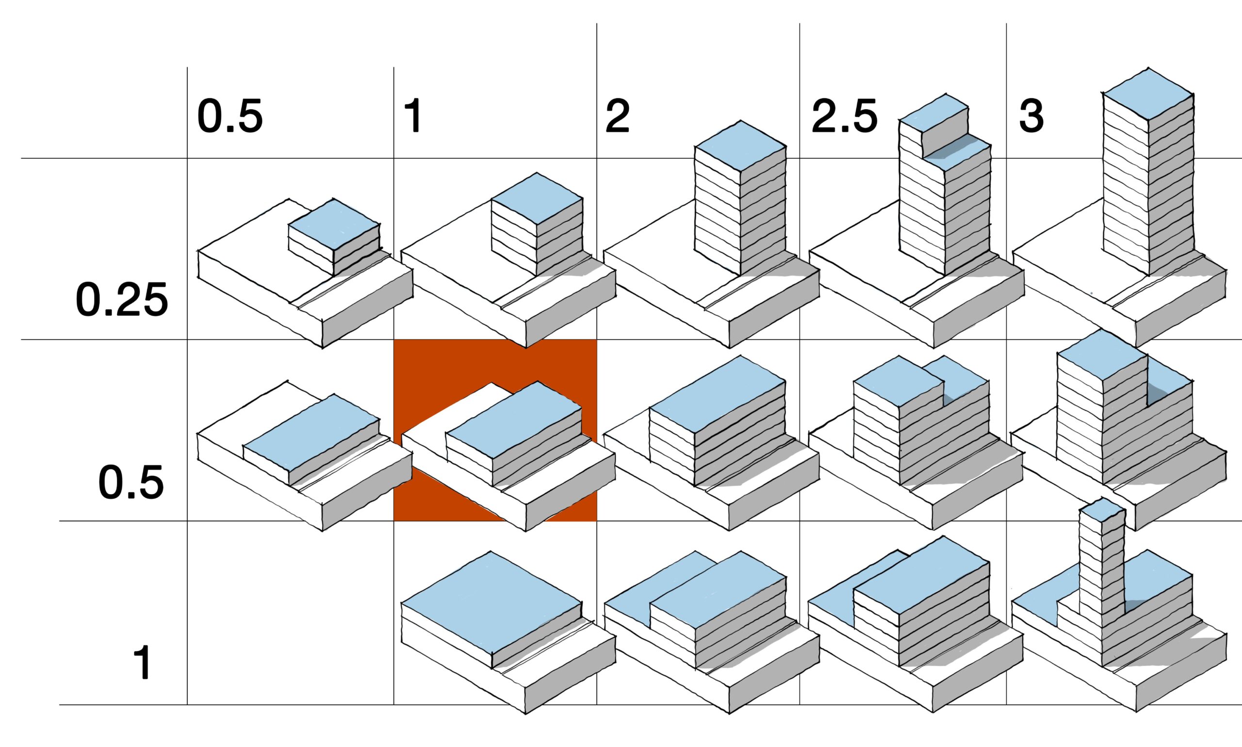
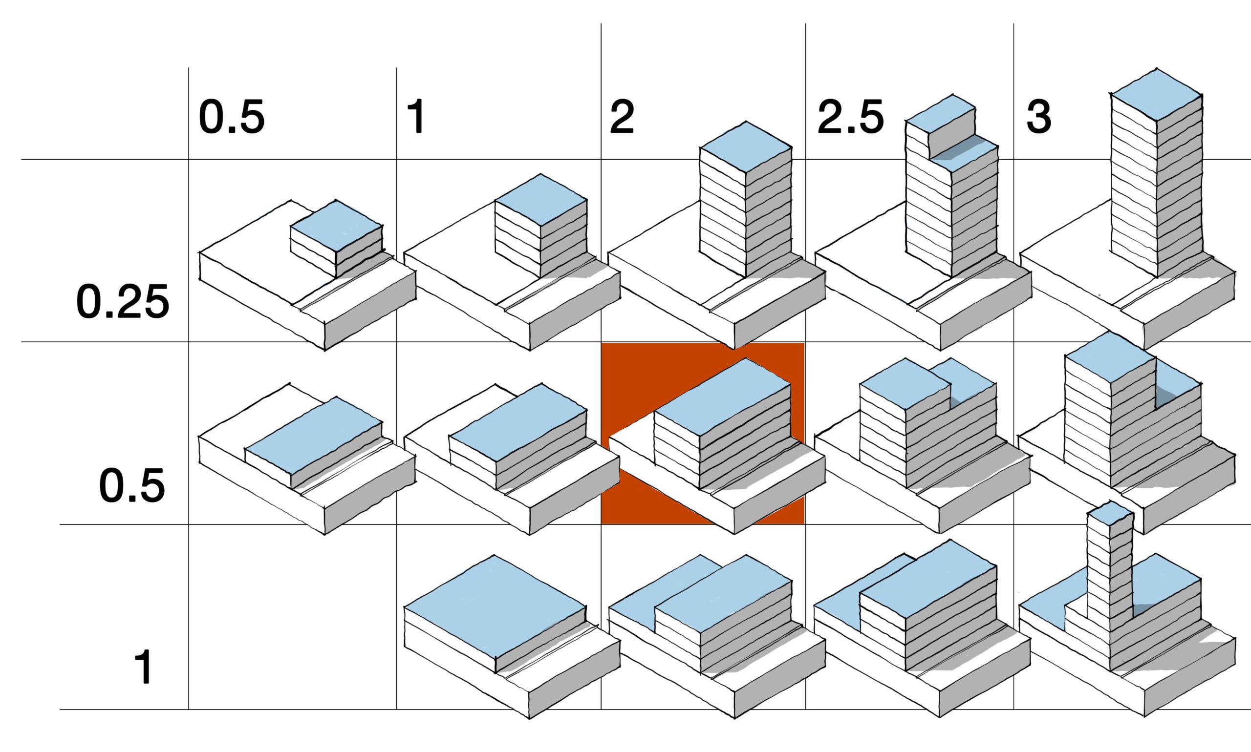
An informal rural lane with mixed plot orientation to respond to the rural character and maximise countryside views. Combination of rural edge development with buildings covering no more than a quarter of the plot and slightly higher density development with buildings covering approximately half of the plot, all retaining maximum of two storeys.
Plot ratio diagram
Buildings:
Hints: Contribution of buildings to the space, size, scale, form (terraced, etc), frontage onto street, materials, windows, doors, condition, use, visible alterations.
SCORE: 4
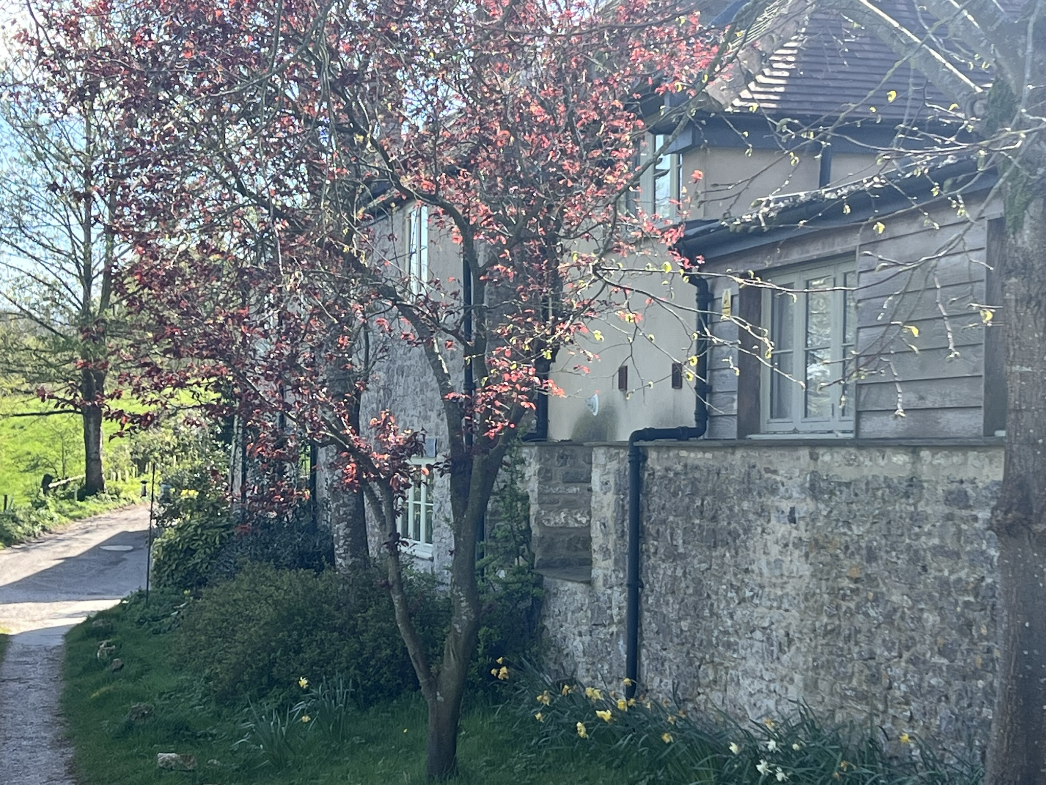
Chawley Lane has a mixture of dwellings ranging from terraced houses (former farm workers’ cottages) to large detached barn and stable conversions. The construction materials vary from traditional rubble stone, brick and pebble dashed or rendered. Many properties have had their windows replaced with a few examples of original timber windows. Hillside Farmhouse at the end of Chawley Lane has original timber windows and has been sympathetically extended to one side. All of the farmhouses’ outbuildings have been converted into dwellings. The size of windows on most houses on Chawley Lane are the same as they would have been originally but many have been replaced with double glazed units with a range of different designs. Brick Kiln Farmhouse at the top of Chawley Lane is an old farmhouse which has been sympathetically extended and restored.
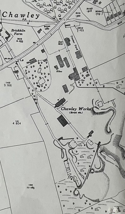
Brick Kiln Farm
The following is an extract from John Hanson’s History of Cumnor and can be found at http://www.bodley.ox.ac.uk/external/cumnor/articles/chawley-works.htm
It explains the origins of the buildings at Chawley. Chawley stands on the Cumnor ridge, a situation that affords fine views to the north and west. Its former claim to fame was its clay and brickworks.
Chawley was well suited for the local production of lime and bricks because of the occurrence there of the materials needed. It stood on strata of Coraillian limestone and Kimmeridge Clay. The availability in the parish of limestone rubble forestalled for many centuries the use of brick in Cumnor, while traditional thatch and Stonesfield slate were preferred to clay tiles.
It may have been the incentive of tax abolition that moved John Neale, a farmer at Chawley, to start making bricks and tiles. He is first mentioned being involved in this trade in 1846. The 1851 census shows John Neale, born in Cumnor, married to Elizabeth, farmer of 70 acres and kiinman, employing 7 labourers.
Bricks had been used in the rear extension of Cumnor vicarage and earlier at Red House Farm and a home in Botley. Nevertheless a big demand did not arise until early Victorian times, when the Great Western Railway’s arrival stimulated a building boom in West Oxford.
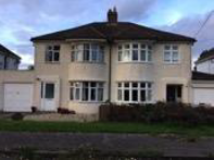
Chawley Works c.1973
The photograph (left) is taken from a newspaper article reporting the demolition of the brickworks chimney. The plan (right) shows No 22 Norreys Rd. This was the first house to be built on Norreys Rd and is of note as it was built with the bricks from Chawley Brick Works.
Greenery and Landscape Features:
Hints: Contribution of trees and plants (colours, shade), hard/urban, private or public, water, changing levels
SCORE: 4
The views of agricultural land at the end of Chawley Lane are exceptional.
There are two Local Wildlife Sites to the rear of Chawley Lane.
A number of footpaths criss cross this area linking it to other parts of the Parish and beyond
Light/Dark: shading, time of day/night
SCORE: 5
Given the height of the buildings and the distance between them there are no shading issues.
Noise & Smell: man made or natural
SCORE: 3
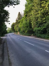
The A420 creates considerable traffic noise (75 decibels) and is at its loudest when the wind is coming from the northerly direction.
Spirit of Place
Spaces
Buildings
Views
Greenery & Landscape Features
Light/ Dark
Noise & smell
4
4
4
5
3
TOTAL SCORE: 23
The area is a quiet place to live, homes and gardens are well tended. There is a sense of being immediately attached to nature due to the proximity of wide open countryside with views stretching towards Wytham Woods. Dog walkers and ramblers from around the Parish and beyond make significant use of the surrounding countryside.
ii. Norreys Road & Bertie Road
Norreys Road & Bertie Road
Spaces: gaps between built elements – streets, gardens etc.
Hints: Formal, building plots (size, building position, etc), means of enclosure, gaps, open, narrow, winding, straight, type of use, paving/surface materials, street furniture, usability, impact of traffic.
SCORE: 4
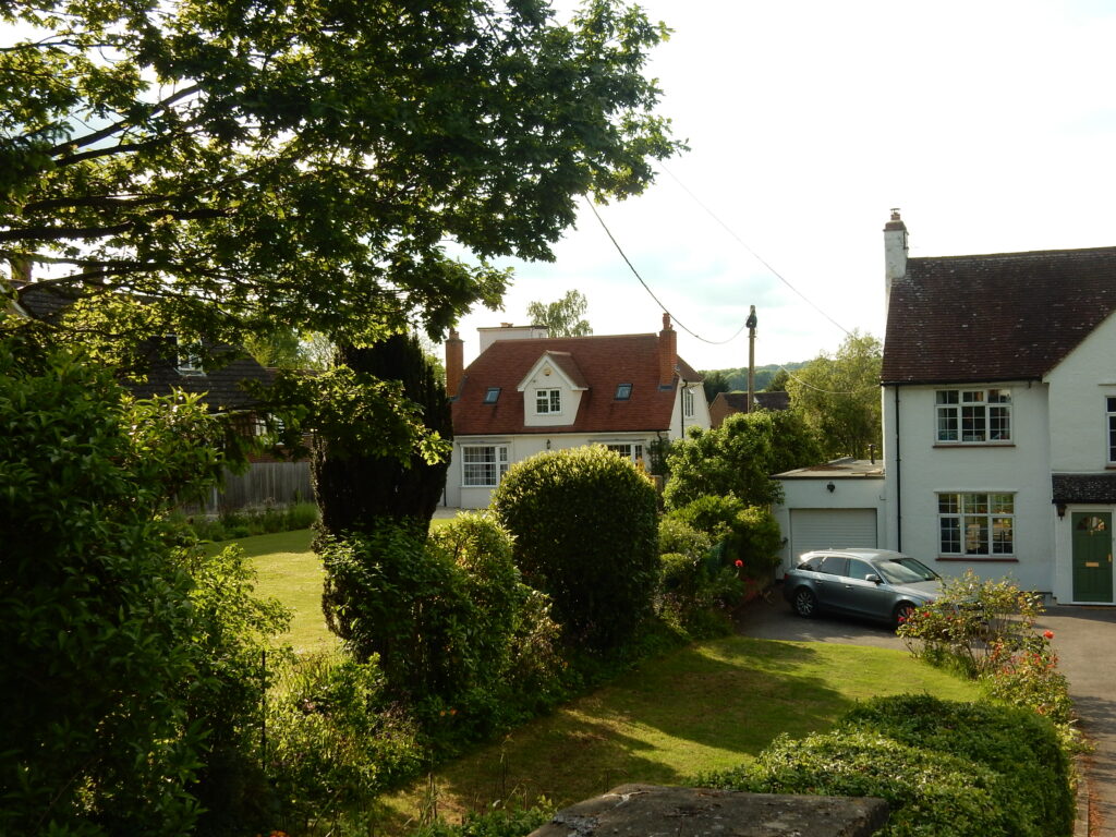
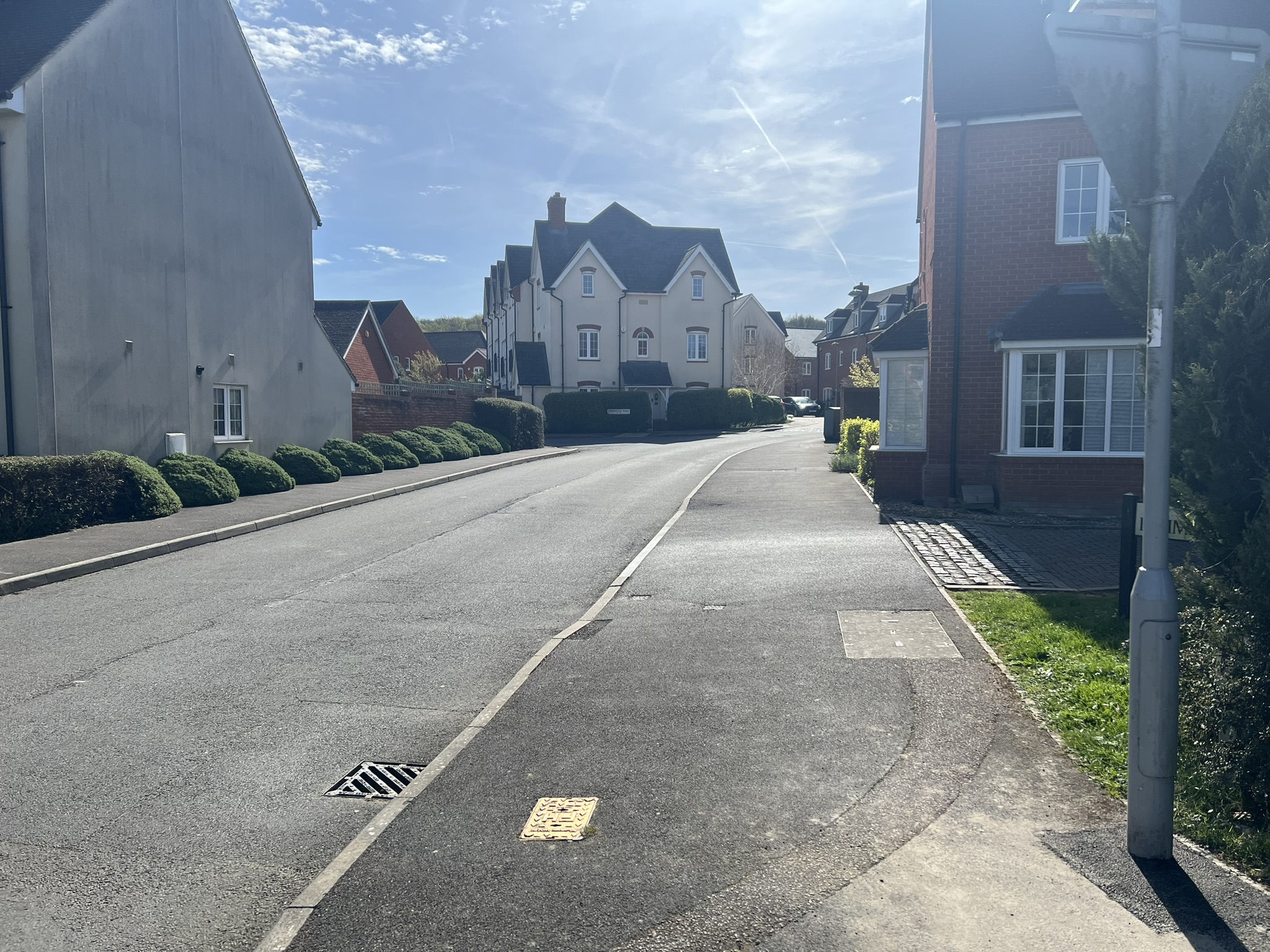
Norreys Road and Bertie Road were developed as a consequence of the financial demise of the 4th Earl of Abingdon, who sold off this tract of land to pay debts. The land was not developed until the 1930s. The buildings at Chawley Lane however, were built to house workers at the Chawley Brickworks and as a result are very different in character. Both types of housing tell the story of the history of the area in quite different ways. Norreys Road and Bertie Road are fully tarmacked roads. Norreys Road is a cul-de-sac which ends in an opening to a field and a footpath. At the junction between Norreys Road and Bertie Road there is a small triangle of grass.
The average density of houses on Norreys Road and Bertie Roads is 1 house per 650m2
Norreys Road and Bertie Road have cars parked on one side of the road which effectively reduces the road space to a single carriage way with passing spaces between parked cars. For most of the day there are cars parked all the way from Norreys Road to Chawley Lane.
Generally rectangular with slight variation to this shape where plots are accommodating curvature and gradients. Irregular plot shapes also feature depending on topography and development history but are not common. Creating additional irregular plot shapes may be resisted as this could undermine the strong character formed by common plot shapes.
Uniform plot layout with front-facing buildings parallel to the road. A balance between buildings and gardens or open space with buildings covering approximately half of total plot size at a maximum of two storey height.
Plot ratio diagram
Buildings:
Hints: Contribution of buildings to the space, size, scale, form (terraced, etc), frontage onto street, materials, windows, doors, condition, use, visible alterations.
SCORE: 5
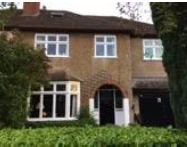
All the buildings on Norreys Road and Bertie Road are either bungalows or 2 storey houses. There is one small 2 storey block of flats at the junction of Norreys Road and Chawley Lane.
Norreys Road and Bertie Road have a number of different styles of dwellings but all are constructed of either brick or are rendered or pebble dashed. The majority of properties are detached with some semi-detached and bungalows. Most properties have been extended either to the rear or side of the property; side extensions are often over the existing garage area. For the most part the houses’ styles are variations on a 1930s design, often in small groups or pairs. The majority of properties have either hip, cross-hipped or intersecting hip tiled roofs. All the houses are parallel to the road.
Example of windows
The photo shows an example of a pebble-dashed house, that has been sympathetically extended to the side
When constructed properties built in the 1930s, 1940s and 1950s would have had leaded light windows. Most of these windows have been replaced with uPVC or aluminium double glazing but a few with original doors and window remain. However, the overall character of the housing is still 1930s – 1950s in style, with good-sized gardens sympathetically accommodating small sheds, greenhouses etc. with plenty of open space.
Many properties on both Norreys Road and Bertie Road have had loft conversions with either a dormer and / or roof windows. Some of the dormer extensions are large and out of character with the other adjoining properties. There are a few bungalows with extensive grounds. All houses on Norreys Road and Bertie Road have a small front garden and off-street parking giving a sense of space to the area.
Views:
Hints: Within the space (long, short, intimate, glimpsed, channelled, wide), focal points, streetscape (how buildings and streets work together), roofscape, views out of the space (long/short distance, high level).
SCORE: 3
The view on Norreys and Bertie Roads are long and this gives a sense of space. At the junction of Norreys Road and Bertie Road, the green triangle and large triangle road space provides an expansive open space.
The views to the rear of houses on the North side of Norreys Road are of open fields with the next visible settlement being Dean Court. The vista from the ends of these gardens is 180 degrees and is uninterrupted.
Greenery and Landscape Features:
Hints: Contribution of trees and plants (colours, shade), hard/urban, private or public, water, changing levels
SCORE: 4
Most of the dwellings along Norreys and Bertie Road have mature front gardens. The views of agricultural land to the rear of Norreys Road. This is a significant and expansive view from Cumnor to Wytham Woods.
Light/Dark: shading, time of day/night
SCORE: 5
Given the height of the buildings and the distance between them there are no shading issues.
Noise & Smell: man made or natural
SCORE: 3
The A420 which runs close to the West end of Norreys and Bertie Road at the end of Norreys Road the loudness of the noise is 75 decibels.
Spirit of Place
Spaces
Buildings
Views
Greenery & Landscape Features
Light/ Dark
Noise & smell
4
4
3
4
5
3
TOTAL SCORE: 23
This is a quiet area to live, with a strong sense of community and a real connection to the countryside it sits within.
iii. Cotswold Road
Cotswold Road
Spaces: gaps between built elements – streets, gardens etc.
Hints: Formal, building plots (size, building position, etc), means of enclosure, gaps, open, narrow, winding, straight, type of use, paving/surface materials, street furniture, usability, impact of traffic.
SCORE: 4
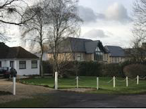
Detached properties set back in front gardens from quiet roadway. Footways paved or tarmac. Generally clean. Plenty of space for residents’ cars but no pavement for pedestrians, although there is a grass verge almost the length of the road.
Generally rectangular with slight variation to this shape where plots are accommodating curvature and gradients. Irregular plot shapes also feature depending on topography and development history but are not common. Creating additional irregular plot shapes may be resisted as this could undermine the strong character formed by common plot shapes.
Uniform plot layout with front-facing buildings substantially set back from the road. Combination of rural edge development with buildings covering no more than a quarter of the plot and slightly higher density development with buildings covering approximately half of the plot, all retaining maximum of two storeys.
Plot ratio diagram
Buildings:
Hints: Contribution of buildings to the space, size, scale, form (terraced, etc), frontage onto street, materials, windows, doors, condition, use, visible alterations.
SCORE: 4
There is no one uniform style of property along this road, however buildings do have strong common denominators. All properties are large and set well back in large plots. There is a mix of one-and two-storey, single dwelling properties. Building materials are generally brick and or render with slate roofs. All roofs are pitched with no flat roofs, adding interest and reducing any appearance of density and massing.
Views:
Hints: Within the space (long, short, intimate, glimpsed, channelled, wide), focal points, streetscape (how buildings and streets work together), roofscape, views out of the space (long/short distance, high level).
SCORE: 4
Open countryside that abuts estate to the east occasionally visible from street level. Streetscape is quiet suburban. The road has recently been resurfaced.
Greenery and Landscape Features:
Hints: Contribution of trees and plants (colours, shade), hard/urban, private or public, water, changing levels
SCORE: 4
Front gardens with mature trees and hedging provide greenery, and soften the streetscene.
One property lacks a front hedge, making it look more open and stand out from the others.
Light/Dark: shading, time of day/night
SCORE: 4
Light, open impression
Noise & Smell: man made or natural
SCORE: 4
Smells from adjacent farming land and garden plants. Pleasant.
Spirit of Place
Spaces
Buildings
Views
Greenery & Landscape Features
Light/ Dark
Noise & smell
4
4
4
4
4
4
TOTAL SCORE: 24
Quiet suburban. This is a private road not adopted by the Vale of White Horse DC
iv. Lower Cumnor Hill – Moved from Dean Court Assessment April 2026
Lower Cumnor Hill – Moved from Dean Court Assessment April 2026
General Character Description
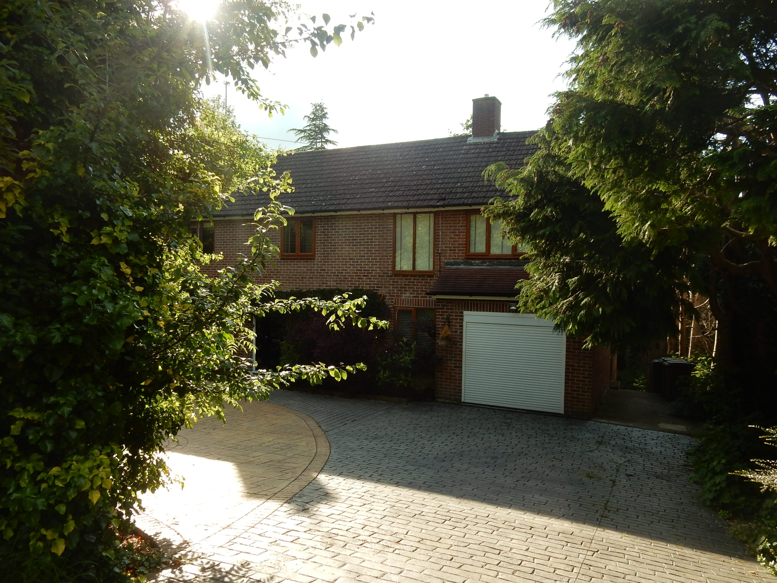
Development on Cumnor Hill started in the first years of the 20th century with a few large houses in very large plots taking advantage of the elevated countryside location and its distant views towards Wytham Woods. Between 1900 and 1914, the Earl of Abingdon began to sell plots on Lower Cumnor Hill. At that time, covenants were imposed to ensure dwellings on plots maintained an open and spacious character. Later housing, built in the1920s and 1930s, still maintained this spacious character.
The houses are generally sited in extensive gardens with many trees, often hidden from the road. The street scene is largely enclosed by stone walls, hedges or trees and the houses set behind long front gardens. The interwar years saw more houses being built, but always in large and well-landscaped plots and at low density with stepped and varied orientations to respond to the hill gradient and countryside views. Distant views, glimpsed between buildings and trees, are still an important element in the streetscape.
Set at the foot of Matthew Arnold’s “green-muffled hills”, the area has a distinctive sylvan character with houses set in mature woodland plots. This is especially true of the south-east side of the hill. Nos 33-55 are built far back so that their front gardens form together a large open space with many mature trees.
As you travel uphill, the road curves sinuously, opening up new views along its length. The road was constructed as a new route in 1826/7 and its winding alignment would have been an original design feature in order to reduce the steepness of the climb. Large mature trees give the road a semi-rural feel and provide a canopy across many parts of the Hill, often hiding the houses and giving a sense of an attractive wooded area. Hedges provide a clear boundary to the road and a noise filter both for traffic and for adjoining properties.
The road frontage is defined with hedges or stone walls which give a sense of enclosure, and extensive planting in gardens and many mature trees dominate the street scene.
In places, the pavements narrow and are occasionally obstructed by overhanging greenery or wheelie bins, making pushchair/wheelchair access difficult.
There are areas of planting or grass between the pavements and the front boundaries of the houses, and driveways are generally inconspicuous and informal. Currently the road surfaces on much of the Hill itself and adjoining roads are pot-holed and uneven. There is a question whether there is a need for traffic calming measures and reduced traffic speeds.
The hill itself is a long slow rising gradient. This makes cycling up the hill only for the fit and brave. It also means that cyclists coming down the hill travel at very significant speeds which, given the restricted visibility from many narrow drive accesses, poses a risk to their safety. Recently, some house plots have been redeveloped for blocks of flats which, with their bulk and formal car parking areas, do not generally align with the area’s green and semi-rural character or conform to the Vale’s adopted Design Guide.
Policy DBC5 in the Cumnor Neighbourhood Plan identifies land at Third Acre Rise and Lower Cumnor Hill as an Area of Special Character.
Plot ratio diagram
Low density rural development with buildings covering no more than a quarter of plot space at a maximum of two storey heights.
Buildings:
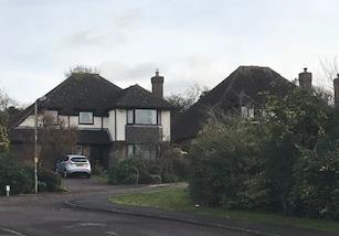
The area is entirely residential and is characterised by detached houses, most built in the interwar years but with a significant number from the 1950s and 1960s. The houses vary in design but almost all are built in a traditional style with brick or rough rendered walls and pitched tiled roofs. Chimneys add to the interest of the roofscape. Windows in most of the houses were originally timber framed and traditional in style, but many now have similarly-designed uPVC double-glazed replacements.
Lower Cumnor Hill Homes
The houses can be large or more modest but almost all are in large plots where garden planting and greenery are the dominant elements. Buildings are unobtrusive and often well hidden from view as they are deeply set back from the road with strong green boundaries. Some recent developments show houses with similar but not identical styles and footprints. There has been refurbishment and sensitive modernisation of older rural properties as well, which gives an attractive mix of buildings.
A number of houses on Lower Cumnor Hill are influenced by the Arts & Crafts movement such as No 32 dating from 1910. No 43 was designed by Harry Smith, and shows the influence of CFA Voysey. Harry Smith also designed the Oxford Crown & County Court building in St Aldates. Many of the houses reflect the Vernacular Revival, which was popular at the time, with brick, or rough rendered walls and clay-tiled roofs.
43 Cumnor Hill – An example of the Arts & Crafts inspired house, and is of particular architectural merit.
However, there have been 3 developments where blocks of flats have replaced detached houses. These are having an increasingly damaging effect on the character of the area, as they are of greater scale, massing and depth, often higher than the area’s existing houses. Some are built with non-traditional materials and have curved or flat roofs which jar with surrounding development.
These developments also often result in the loss of planting, trees, and hedges, and the greater prominence of the new buildings in the streetscape. This is accentuated by wide and hard-engineered accesses which open up the road frontage, and formally- laid-out car parking areas replacing domestic front gardens.
Views:
Wytham Woods are visible to the north, and this becomes an important vista. Glimpses of countryside can be seen up lanes and through avenues of trees. This reinforces a feeling of tranquility and space.
The topography of the area plays a large part in its character. The road itself slopes down from the south-west to the north-east and there is also a marked slope down across the road from the south-east to the north-west. This creates long views and is a key part of the area’s character. Most of the houses on the upper south east side are sited well back on their plots in elevated positions enjoying distant views with long and well-treed front gardens.
The road has several gentle curves which contain views along it and add to its attractive character. The enclosure of the road by walls, hedges, trees, and other planting generally contains the view but also affords glimpses of houses along drives or between trees, as well as some distant views northwards towards Wytham Hill and Woods.
The overwhelming sense of the Lower Cumnor Hill area is one of mature trees lining the hill. A number of odd numbered houses have retaining banks or stone walls on their frontages to the road with dense tree or hedge screening and these form important elements to the street scene.
On the north west side of Cumnor Hill, the even numbered houses are generally at a lower level than the road, with long back gardens which fall away to the north west. Open views towards Wytham Woods can be glimpsed.
Due to the underlying geology, the area has many springs and groundwater channels. During heavy rainfall, surface water frequently overwhelms the surface water sewer and runs across the road and along the edges of pavements of Lower Cumnor Hill. Inrecent years, there has been increased waterlogging in Third Acre Rise gardens, together with regular instances of flooding in Orchard Road, Eynsham Road and Deanfield Road.
Cumnor Rise Road used to have a stream running down the side of it, now enclosed.
Light/Dark: shading, time of day/night
Lower Cumnor Hill is lit with street lighting, but adjoining lanes, for example Cumnor Rise Road, is dimly lit and this gives the area a real sense of rural woodland.
Noise & Smell: man made or natural
Traffic has increased over the last 5 years with new developments adding considerably to the overall volume of traffic along Cumnor Hill, for example Kimmeridge Rd located at the top of Cumnor Hill with its additional 192 new dwellings.
Spirit of Place
As soon as you reach the Cumnor Parish boundary at Cumnor Rise Road,, and begin your journey up Cumnor Hill, you sense the stark contrast between urban city life and a semi rural residential area. Large mature trees and green boundaries indicate a change in land usage. Houses are hidden from view. Trees and shrubbery overhang the walkways and provide a shaded canopy, in complete contrast to the hustle and bustle of the shops and urban environment of Botley.
Birdsong is all around, highlighting the area’s importance as habitat for a diverse range of wildlife.A well-documented badger sett exists at 40 Cumnor Hill. Both muntjac and fallow deer are present, and forage in the rear gardens.
Recent higher density developments are at odds with the character of the area.
v. Cumnor Hill to Chawley Lane (Arnolds Way to Chawley Lane/No136 inc Colegrove Down & Hillside)
Cumnor Hill to Chawley Lane (Arnolds Way to Chawley Lane/No136 inc Colegrove Down & Hillside)
Spaces: gaps between built elements – streets, gardens etc.
Hints: Formal, building plots (size, building position, etc), means of enclosure, gaps, open, narrow, winding, straight, type of use, paving/surface materials, street furniture, usability, impact of traffic.
SCORE: 4
Mainly large detached properties set back in front gardens. Many trees and hedges. Occasional views of open countryside from road – good views from some properties. Main road straight, footways tarmac, poorly maintained in places, substantial weed growth/leaf litter accumulation in places. Traffic noise and smells unpleasant when on main road. Quiet once off main road.
Generally rectangular with slight variation to this shape where plots are accommodating curvature and gradients. Irregular plot shapes also feature depending on topography and development history but are not common. Creating additional irregular plot shapes may be resisted as this could undermine the strong character formed by common plot shapes.
Linear plot layout with front-facing buildings set back from the road. A balance between buildings and gardens or open space with buildings covering approximately half of total plot size at a maximum of two storey height.
Plot ratio diagram
Buildings:
Hints: Contribution of buildings to the space, size, scale, form (terraced, etc), frontage onto street, materials, windows, doors, condition, use, visible alterations.
SCORE: 4
Mainly large detached properties. Many of the more substantial plots on the main road now subdivided. Styles vary, mainly brick. Large number 1930s–50s houses remain on main road: roads off generally 1960s-2000s. Front gardens / green frontages present, even for newer properties: these are important to the street-scene. Recent care home and apartment developments appear stark as not built in styles in keeping with their surroundings
Views:
Hints: Within the space (long, short, intimate, glimpsed, channelled, wide), focal points, streetscape (how buildings and streets work together), roofscape, views out of the space (long/short distance, high level).
SCORE: 3
Views mainly limited to road/houses when walking on main road and uphill side roads: limited longer views from street level. Views limited from street level by steep slope downhill Hillside & Colegrove Down.
Greenery and Landscape Features:
Hints: Contribution of trees and plants (colours, shade), hard/urban, private or public, water, changing levels
SCORE: 5
High impact of mature trees and hedges, particularly on Cumnor Hill – overall impression is of trees and greenery rather than of buildings. Trees/hedges reduce visibility of housing from Cumnor Hill; protect properties/gardens from traffic noise and overlooking.
Light/Dark: shading, time of day/night
SCORE: 3
Light, open impressions. Good street lighting main road.
Noise & Smell: man made or natural
SCORE: 2
Traffic noise (and smells) substantial on main road, but not off main road. Away from main road, green smells and flowers.
Spirit of Place
Spaces
Buildings
Views
Greenery & Landscape Features
Light/ Dark
Noise & smell
4
4
3
5
3
2
TOTAL SCORE: 21
Leafy and green, family homes, traffic can be intrusive
vi. Cumnor Hill Top
Cumnor Hill Top (Chawley Lane to Oxford Road)
Spaces: gaps between built elements – streets, gardens etc.
Hints: Formal, building plots (size, building position, etc), means of enclosure, gaps, open, narrow, winding, straight, type of use, paving/surface materials, street furniture, usability, impact of traffic.
SCORE: 4
Generally a continuation of the street-scene lower down Cumnor Hill, with detached properties set back in leafy front gardens, usually with hedges, including many mature trees. Typical Cumnor Hill street-scene is interrupted by car sales outlets.
Generally rectangular with slight variation to this shape where plots are accommodating curvature and gradients. Irregular plot shapes also feature depending on topography and development history but are not common. Creating additional irregular plot shapes may be resisted as this could undermine the strong character formed by common plot shapes.
Linear plot layout with front-facing buildings set back from the road. Low density with buildings covering a quarter of total plot size at a maximum of two storey height.
Plot ratio diagram
Buildings:
Hints: Contribution of buildings to the space, size, scale, form (terraced, etc), frontage onto street, materials, windows, doors, condition, use, visible alterations.
SCORE: 3
Detached properties set back in leafy front gardens/hedges with mature trees, as elsewhere on Cumnor Hill. Two car sales outlets clustered at the junction with Chawley Lane are very obvious, different from other buildings, much more stark in appearance and exposed to view. Chawley Park industrial estate is well hidden from the main road. Beard’s premises are not conspicuous as housed in a much-extended ex-residential property set back in a large plot. Newly built Care Home is conspicuous (both in daylight and at night because of lighting) from the street and surrounding houses.
Views:
Hints: Within the space (long, short, intimate, glimpsed, channelled, wide), focal points, streetscape (how buildings and streets work together), roofscape, views out of the space (long/short distance, high level).
SCORE: 5
Green belt/countryside views to S and SE between buildings, through to open agricultural land on both sides of the road from the junction with Oxford Road.
Greenery and Landscape Features:
Hints: Contribution of trees and plants (colours, shade), hard/urban, private or public, water, changing levels
SCORE: 5
With full rural scene from the Oxford Road junction through to the junction with the B4017, the top of Cumnor Hill is semirural-to-rural. The car sales and kitchen outlets detract from the street-scene. Footpaths radiate from the locality connecting it to other parts of the Parish and beyond
Light/Dark: shading, time of day/night
SCORE: 3
Generally light and open. Good street lighting at night
Noise & Smell: man made or natural
SCORE: 2
Traffic noise and smell can be intrusive – green frontages are very important in reducing traffic noise and smell for residents. Once away from main road, quiet.
Spirit of Place
Spaces
Buildings
Views
Greenery & Landscape Features
Light/ Dark
Noise & smell
4
3
5
5
3
2
TOTAL SCORE: 22
At the edge of the countryside, leafy
vii. Delamere Road
Delamare Road (inc Barn Close & Halls Close)
Spaces: gaps between built elements – streets, gardens etc.
Hints: Formal, building plots (size, building position, etc), means of enclosure, gaps, open, narrow, winding, straight, type of use, paving/surface materials, street furniture, usability, impact of traffic.
SCORE: 3
A recent development resulting in a consistent design of houses. Little space between small/medium detached properties. Higher density than surrounding developments. Streets block-paved or tarmac. Front gardens small and mainly unenclosed.
Generally rectangular with slight variation to this shape where plots are accommodating curvature and gradients. Irregular plot shapes also feature depending on topography and development history but are not common. Creating additional irregular plot shapes may be resisted as this could undermine the strong character formed by common plot shapes.
A tight, consistent modern plot layout with buildings close together mainly facing the narrow estate road. A balance between buildings and gardens or open space with buildings covering approximately half of total plot size at a maximum of two storey height.
Plot ratio diagram
Buildings:
Hints: Contribution of buildings to the space, size, scale, form (terraced, etc), frontage onto street, materials, windows, doors, condition, use, visible alterations.
SCORE: 3
Properties detached but not substantial. Close together but with private space. Detail varied by developers, so doesn’t appear too similar. All houses are built in brick or brick and render, with slate roofs. Many have chimneys with varying roof heights which adds interest to the overall estate.
Views:
Hints: Within the space (long, short, intimate, glimpsed, channelled, wide), focal points, streetscape (how buildings and streets work together), roofscape, views out of the space (long/short distance, high level).
SCORE: 3
Properties in Halls Close have strong views to the rear of the properties. Howevere, in the main, the density of housing gives a suburban feel to the area. The central open green space very important, providing open view and light and is an amenity well used by residents.
Greenery and Landscape Features:
Hints: Contribution of trees and plants (colours, shade), hard/urban, private or public, water, changing levels
SCORE: 2
Closeness of properties leads to lack of openness. Garden greenery important to variation in street scene. Front gardens are all open with sufficient off-street parking to ensure parking is not an issue. An exception to this is the recent development of Cumnor Hill House Care Home which resulted in issues over parking at the junction of Cumnor Hill and Delamare Road. Other recent construction has reinforced this problem.
Light/Dark: shading, time of day/night
SCORE: 2
Feels quite enclosed/shaded
Noise & Smell: man made or natural
SCORE: 3
Quiet
Spirit of Place
Spaces
Buildings
Views
Greenery & Landscape Features
Light/ Dark
Noise & smell
3
3
3
2
2
3
TOTAL SCORE: 16
Suburban, quiet
viii. Hurst Lane
Hurst Lane
Spaces: gaps between built elements – streets, gardens etc.
Hints: Formal, building plots (size, building position, etc), means of enclosure, gaps, open, narrow, winding, straight, type of use, paving/surface materials, street furniture, usability, impact of traffic.
SCORE: 5
Open countryside to the southeast visible from most of this unadopted road, where strip of common land abuts roadway.
Generally rectangular with slight variation to this shape where plots are accommodating curvature and gradients. Irregular plot shapes also feature depending on topography and development history but are not common. Creating additional irregular plot shapes may be resisted as this could undermine the strong character formed by common plot shapes.
Irregular plot positioning often angled to maximise views. A balance between buildings and gardens or open space with buildings covering approximately half of total plot size at a maximum of two storey height.
Plot ratio diagram
Buildings:
Hints: Contribution of buildings to the space, size, scale, form (terraced, etc), frontage onto street, materials, windows, doors, condition, use, visible alterations.
SCORE: 4
With the exception of an attractive short terrace that were brick-workers’ cottages, properties are detached. In the first 100–200m off Cumnor Hill, properties are not in a regular pattern, Most of the lane has properties only on the NW side, which are set back from the roadway in front gardens. Style of properties very variable.
Views:
Hints: Within the space (long, short, intimate, glimpsed, channelled, wide), focal points, streetscape (how buildings and streets work together), roofscape, views out of the space (long/short distance, high level).
SCORE: 5
Good views of open countryside and farmland
Greenery and Landscape Features:
Hints: Contribution of trees and plants (colours, shade), hard/urban, private or public, water, changing levels
SCORE: 5
Open countryside dominates. Front gardens provide colour and variety. Footpaths and a bridleway link the locality with other parts of the Parish and beyond
Light/Dark: shading, time of day/night
SCORE: 3
Daytime open and light. It’s poorly lit at night.
Noise & Smell: man made or natural
SCORE: 4
Quiet. Smells are from open countryside.
Spirit of Place
Spaces
Buildings
Views
Greenery & Landscape Features
Light/ Dark
Noise & smell
5
4
5
5
3
4
TOTAL SCORE: 26
Secluded residences abutting open countryside
ix. Kimmeridge Road Estate
Kimmeridge Road Estate (inc Seven Sisters)
Spaces: gaps between built elements – streets, gardens etc.
Hints: Formal, building plots (size, building position, etc), means of enclosure, gaps, open, narrow, winding, straight, type of use, paving/surface materials, street furniture, usability, impact of traffic.
SCORE: -1
New estate (2010s), high density with wooded countryside (fenced off) to the SE. Roads narrow, mainly block-paved, some tarmac. Most footways also block-paved; often used for car parking. Footways hard to discern from roadways. Back gardens not visible as high-walled. Many properties front directly onto the roadway.
Generally rectangular with slight variation to this shape where plots are accommodating curvature and gradients. Irregular plot shapes also feature depending on topography and development history but are not common. Creating additional irregular plot shapes may be resisted as this could undermine the strong character formed by common plot shapes.
High-density estate plot layout with little variation in alignment. Narrow frontage plots and buildings commonly front directly onto the road. Buildings covering approximately half of total plot with two and three storeys in height.
Plot ratio diagram
Buildings:
Hints: Contribution of buildings to the space, size, scale, form (terraced, etc), frontage onto street, materials, windows, doors, condition, use, visible alterations.
SCORE: -2
Properties vary from blocks of flats (six of 2 or 3 storeys, conspicuous) to small terraced through to substantial detached. Properties have a uniform design, brick-built, but often fully or part rendered. Easy to not know exactly where you are because it all looks the same. Roof-lines do vary, as does some detailing (e.g. part-tiled walls).
Parking is often an issue, with parking on pavements evident throughout the day and night.
Views:
Hints: Within the space (long, short, intimate, glimpsed, channelled, wide), focal points, streetscape (how buildings and streets work together), roofscape, views out of the space (long/short distance, high level).
SCORE: 1
On the S/E periphery, good views of open space. Otherwise open views very limited. On Cumnor Hill frontage, green space between houses and main road present but lacks mature trees. Streetscape is hard urban paving, with some road users and pedestrians sharing space in some areas of the estate.
Greenery and Landscape Features:
Hints: Contribution of trees and plants (colours, shade), hard/urban, private or public, water, changing levels
SCORE: -3
Many properties have very small, front plots, however a significant number front onto the roadway. Some houses have a small area of green, but many house frontages are given over to hard landscaping for parking or wheelie bins. Overall impression is of hard landscaping. No trees or mature green shrubbery to soften the streetscape. Back gardens are surrounded by high walls. Greenery/landscape lacking except at periphery.
The one area of communal green space is very small (see photo). To the rear of the estate, there is a children’s play area.
Light/Dark: shading, time of day/night
SCORE: 2
Daylight okay. Street lighting okay. Due to the height of the buildings, some areas seem shaded.
Noise & Smell: man made or natural
SCORE: 1
Quiet
Spirit of Place
Spaces
Buildings
Views
Greenery & Landscape Features
Light/ Dark
Noise & smell
-1
-2
1
-3
2
1
TOTAL SCORE: -2
Overall impression is of hard-landscaped suburban area, which is at odds with its surroundings. As time goes on, the trees fronting Cumnor Hill have begun to soften the street scene here, but within the development, there is little opportunity to introduce any hedging or trees.
x. Hid’s Copse
Hid’s Copse
Spaces: gaps between built elements – streets, gardens etc.
Hints: Formal, building plots (size, building position, etc), means of enclosure, gaps, open, narrow, winding, straight, type of use, paving/surface materials, street furniture, usability, impact of traffic.
SCORE: 5
This is a well maintained private road with a tarmac surface throughout its length. The plots vary in size from ½ acre to over 2 acres and several own fields as well. There are no pavements, just grass verges with a variety of large stones on them to deter parking, especially on those verges nearest to the main road. The lighting is poor /subdued. There are hedges throughout to delineate the plots and screen them from the road. One or two plots have fences along part of their boundary.
Generally rectangular with slight variation to this shape where plots are accommodating curvature and gradients. Irregular plot shapes also feature depending on topography and development history but are not common. Creating additional irregular plot shapes may be resisted as this could undermine the strong character formed by common plot shapes.
Buildings set far back with varied alignments substantially screened by hedges and trees. Very low density rural edge of settlement development with buildings covering no more than a quarter of the total plot and a maximum of two storeys.
Plot ratio diagram
Buildings:
Hints: Contribution of buildings to the space, size, scale, form (terraced, etc), frontage onto street, materials, windows, doors, condition, use, visible alterations.
SCORE: 5
Each plot has a large or very large house standing well back from the road. The designs vary enormously. Some are modest and some of the more recent ones are large and have replaced more modest buildings. The earliest date from the 1930s when land was sold by the Earl of Abingdon and divided into sizeable plots, which, over the years have often been divided further.
Most buildings are two storeys high but some have further accommodation in the attic and are thus three storeys high. Garaging for cars is usually present either integral to the house or as a separate building. One or two have converted the garage to living space. No one building is alike but most of them are well maintained which has not always been the case in the past.
Views:
Hints: Within the space (long, short, intimate, glimpsed, channelled, wide), focal points, streetscape (how buildings and streets work together), roofscape, views out of the space (long/short distance, high level).
SCORE: 4
On the whole, more intimate views are rare from the road and the properties tend to be well screened from one another except where recent property development has included tree felling and replacement planting has not grown up
Greenery and Landscape Features:
Hints: Contribution of trees and plants (colours, shade), hard/urban, private or public, water, changing levels
SCORE: 5
Private road, unadopted. Well maintained tarmac surface due to a well organised residents association which dates from the 1980s. There are a large number of mature trees in this area although in recent years property development has meant that many have been felled to accommodate redevelopment i.e. larger houses. Hedges abound. Laurel fronts those on the entrance road but further along the hedges are more varied and some are less well clipped. The impression is of a soft, private landscape with occasional view beyond due to the gradual slope of the hill.
Light/Dark: shading, time of day/night
SCORE: -5 or 5
There is minimal street lighting out of resident’s choice, so scoring this depends on preference!
Noise & Smell: man made or natural
SCORE: 4
If the prevailing wind from the southwest is blowing then noise from the A420 can be considerable. This is most noticeable on Friday and Sunday evenings and especially so for those furthest down the road and nearer to the A420
Plane noise from Brize Norton flights can be considerable at times.
Bird song at dawn and dusk can be delightful but has lessened over the years as have the calls at night of foxes, owls and Muntjac which suggest significant pressure from development
Spirit of Place
Spaces
Buildings
Views
Greenery & Landscape Features
Light/ Dark
Noise & smell
5
5
4
5
-5 or 5
4
TOTAL SCORE: 28 (or 18)
Quiet, secluded and well presented
xi. Oxford Road
Oxford Road (A420 Bridge to Cumnor Hill)
Spaces: gaps between built elements – streets, gardens etc.
Hints: Formal, building plots (size, building position, etc), means of enclosure, gaps, open, narrow, winding, straight, type of use, paving/surface materials, street furniture, usability, impact of traffic.
SCORE: 4
Oxford Road from the bridge to Cumnor Hill This is a road with mostly wide and deep plots fronted with hedges and a few walls and fences. Front gardens are relatively large. Residences are all on the north side of the road, with a wide grass verge and a hawthorn hedge on the south bordering the farmland beyond. The pavement is on the north side and tarmacked.
Between Bertie Road and the bridge there is a widening triangle of grass with three trees in front of the houses necessitated by the relocation of the road when the Cumnor Hill bypass was built.
There are two bus stops each way. Parking is not usually a problem but very recently there has been a sharp increase because of building work on Cumnor Hill. There is an increase of traffic at peak times because it cuts through from Farmoor. Speed limit is 30mph.
There is one bench next to the bridge.
Generally rectangular with slight variation to this shape where plots are accommodating curvature and gradients. Irregular plot shapes also feature depending on topography and development history but are not common. Creating additional irregular plot shapes may be resisted as this could undermine the strong character formed by common plot shapes.
Uniform plot layout with front-facing buildings substantially set back from the road. A balance between buildings and gardens or open space with buildings covering no more than a quarter of total plot size at a maximum of two storey height.
Plot ratio diagram
Buildings:
Hints: Contribution of buildings to the space, size, scale, form (terraced, etc), frontage onto street, materials, windows, doors, condition, use, visible alterations.
SCORE: 4
The oldest houses on Oxford Road are the five semi-detached properties known as Chawley Villas, (nos 2 – 20) which were built ca 1910 and were indeed in the hamlet of Chawley. There are two large semis at each side of the Bertie Road junction, and the rest of the houses are detached, with two being bungalows that have been extended upwards. All were built before 1970, and are a mix of styles. Nearly all are well kept. A number have had extensions such as dormer windows and gable ends, so no two are identical.
Views:
Hints: Within the space (long, short, intimate, glimpsed, channelled, wide), focal points, streetscape (how buildings and streets work together), roofscape, views out of the space (long/short distance, high level).
SCORE: 5
All the properties on this stretch of the road, which is probably the highest in Cumnor, enjoy fabulous and extensive long views to the south across farmland to Boars Hill across the Vale to the Berkshire Downs. Didcot Power Station is clear in the distance. White Horse Hill can be seen on a clear day!
They also form the first view of the village when travelling from the south, and form a critical role in preserving the sense of entering a rural, open space. The view north is of the gardens and houses of Bertie Road and Norreys Road though from high windows or between houses Wytham Woods can be seen.
Greenery and Landscape Features:
Hints: Contribution of trees and plants (colours, shade), hard/urban, private or public, water, changing levels
SCORE: 5
A row of well grown mixed native trees are along the hedge on the south side of the road, and are in themselves an amenity, providing some shade in the summer and beautiful foliage except in winter. Many of the houses have trees and shrubs along the frontage.
Light/Dark: shading, time of day/night
SCORE: 3
The night time blackness of the area was spoilt in the seventies when high orange streetlights were installed from the Cumnor Hill end of Oxford Road up to the junction with the Wootton Road, which was still the main A420. These remained even after the building of the bypass.
However recently more subtle bulbs have been installed and some of the lights are switched off in the early hours, so the light pollution is not quite so bad. However, when looking south at night it is not easy to see the stars.
Noise & Smell: man made or natural
SCORE: 3
The noise of the A420 is not very noticeable at the Cumnor Hill end of the road, but increases as the bridge is approached. There are no smells except occasionally when there is muck-spreading on the fields.
Spirit of Place
Spaces
Buildings
Views
Greenery & Landscape Features
Light/ Dark
Noise & smell
4
4
5
5
3
3
TOTAL SCORE: 24
The feeling is of open-ness and a close connection with the countryside. The most important amenity is that there are no buildings on the south side of the road. There is a growing spirit of neighbourliness and community.
xii. Clover Close and Turnpike Road
Clover Close and Turnpike Road
Spaces: gaps between built elements – streets, gardens etc.
Hints: Formal, building plots (size, building position, etc), means of enclosure, gaps, open, narrow, winding, straight, type of use, paving/surface materials, street furniture, usability, impact of traffic.
SCORE: 4
Clover Close and Turnpike Road forms an estate built by Pye Homes in 1967-69.The estate is carefully laid out. Houses are set within their plots in such away as to minimise overlooking by neighbours. Each house is detached withample space between buildings; this gives an impression of space.
The gentle winding nature of the close, which has a gradual incline, leads to a reduction in traffic speed. The fact that it is a cul-de-sac also reduces the volume of traffic on the estate.
Originally, each house had a covenant, which stated that houses must have ‘ a low chain fence with wooden posts’ rather than a hard fence or hedging. The majority of houses retain this feature.
Street furniture is minimal. Pavements are in good repair, as is the road.
There is typically only one dwelling per plot.
The approach to Clover Close is via Cotswold Road. This road is in very poor repair and gives a negative impression of the area.
Generally rectangular with slight variation to this shape where plots are accommodating curvature and gradients. Irregular plot shapes also feature depending on topography and development history but are not common. Creating additional irregular plot shapes may be resisted as this could undermine the strong character formed by common plot shapes.
Gently winding cul-de-sac plot layout carefully staggered with buildings arranged to minimise overlooking. A balance between buildings and gardens or open space with buildings covering approximately half of total plot size at a maximum of two storey height.
Plot ratio diagram
Buildings:
Hints: Contribution of buildings to the space, size, scale, form (terraced, etc), frontage onto street, materials, windows, doors, condition, use, visible alterations.
SCORE: 4
The typically 4 bedroomed, detached houses are built of light brick or render with clay tile roofs. Chimneys add to the interest, and are often a feature of the design of the house. Each house has ample parking space and an open front garden. There have been few changes to the houses, although some of the houses abutting Cumnor Hill1 have rear extensions with flat roofs. These are barely seen from the front of the houses.
The photo shows a typical house on the estate.
Viewing from the front, roofs are pitched, with the occasional house having a chalet style roof with dormer window. This adds interest to the street scene.
Houses have built in garages, which are still used for cars, so many driveways are free of cars also. There is very rarely any parking on the street.
The photo (above) shows a typical house on the estate.
Houses are no more than two storeys. Many windows have been replaced by uPVC windows. As the buildings have been built with set back or at some distance from its neighbouring property, a sense of privacy has been maintained.
Houses and gardens are extremely well maintained.
Views:
Hints: Within the space (long, short, intimate, glimpsed, channelled, wide), focal points, streetscape (how buildings and streets work together), roofscape, views out of the space (long/short distance, high level).
SCORE: 5
There are expansive views from the south-east out towards Cumnor Hill2. Within the space of the close itself, the winding nature of the road leads to short views which give a sense of clusters of buildings grouped around a small area, rather than of a sprawling estate.
The space between plots and buildings give the sense of a well-planned place to live that is not cramped or over-developed.
Cumnor Hill in this instance refers to the physical feature, which is named Cumnor Hill, not the road of the same name. ↩︎
Hints: Contribution of trees and plants (colours, shade), hard/urban, private or public, water, changing levels
SCORE: 4
Front gardens with mature trees and hedging provide greenery, and soften the streetscene.
Light/Dark: shading, time of day/night
SCORE: 4
Most gardens are not in shade, this is partly due to the open frontages but also given the winding nature of the road itself.
Street lights are now LEDs, and as a consequence, at night, the street light is more focused downwards to the road and pavement.
Noise & Smell: man made or natural
SCORE: 3
The area is tranquil, with a peaceful atmosphere. Low traffic means that traffic noise is barely noticed.
Spirit of Place
Spaces
Buildings
Views
Greenery & Landscape Features
Light/ Dark
Noise & smell
4
4
5
3
4
3
TOTAL SCORE: 23
Many residents in Clover Close have been here many years. There is a strong sense of community, and the Residents Association is particularly active. Being so close to the beautiful walking areas of The Hurst is a significant positive amenity for residents of this road.